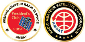
The 2024 Coins Are Here Now!
Help Support GOLF and Fox Plus.
Join the AMSAT President’s Club today!
The AMSAT Journal

The AMSAT Journal is a bi-monthly digital magazine for amateur radio in space enthusiasts, published by the Radio Amateur Satellite Corporation (AMSAT). Each issue is your source for hardware and software projects, technical tips, STEM initiatives, operational activities, and news from around the world. Join AMSAT today to start receiving your bi-monthly issue of The AMSAT Journal. Members can access the latest issue of The AMSAT Journal as well as archived editions on the membership portal.
Join or Renew Today

As a member of AMSAT, you are helping to sustain amateur radio’s presence in space. Your membership supports AMSAT activities such as
- working in partnership with government, industry, educational institutions, and fellow amateur radio societies to foster Amateur Radio’s participation in space research and communication,
- designing and building communication satellites to operate in the harsh environment of space,
- managing those satellites, once they are in orbit, and ensure they are available for public use,
- promoting space education and bringing space-based STEM initiatives to life,
- providing opportunities for students to speak with astronauts aboard the International Space Station (ISS), and
- collecting, compiling, and sharing what is learned with not only AMSAT members, but, with the World!
Join, renew, and manage your AMSAT membership on our new member management portal powered by Wild Apricot. If you are a current member, click here for instructions on accessing your account.
About
The Radio Amateur Satellite Corporation, or AMSAT, is a worldwide group of Amateur Radio Operators (Hams). It was formed in the District of Columbia in 1969 as an educational organization.
For over 50 years, AMSAT groups in North America and elsewhere have played a key role in significantly advancing the state of the art in space science, space education, and space technology. The work now being done by AMSAT volunteers throughout the world will continue to have far-reaching, positive effects on the future of both Amateur Radio, as well as other governmental, scientific and commercial activities in the final frontier.
Rarely have a group of “amateur” volunteers managed to do so much…for so many…with so little.

Mission
AMSAT’s goal is to foster Amateur Radio’s participation in space research and communication. The Organization was founded to continue the efforts, begun in 1961, by Project OSCAR, a west coast USA-based group which built and launched the very first Amateur Radio satellite, OSCAR, on December 12, 1961, barely four years after the launch of Russia’s first Sputnik.
Today, the “home-brew” flavor of these early Amateur Radio satellites lives on, as most of the hardware and software now flying on even the most advanced AMSAT satellites is still largely the product of volunteer effort and donated resources. Though we are fond of traditions our designs and technology continue to push the outside of the envelope.

Updates

ANS-112 AMSAT News Service Weekly Bulletins
In this edition: The AMSAT News Service bulletins are a free, weekly news and information service of AMSAT, the Radio Amateur Satellite Corporation. ANS publishes news related to Amateur Radio in Space including reports on the activities of a worldwide group of Amateur Radio operators who share an active interest in designing, building, launching and … Read more
ANS-105 AMSAT News Service Weekly Bulletins
In this edition: * NASA Astronaut Loral O’Hara, Crewmates Return from ISS * 2024 AMSAT/TAPR Banquet To Be Held Friday, May 17 * New NASA Strategy Envisions Sustainable Future for Space Ops * Trash From The ISS May Have Hit A House In Florida * VUCC and DXCC Satellite Standings for April 2024 * Changes … Read more
2024 AMSAT/TAPR Banquet at Hamvention to be Held Friday May 17th
AMSAT News Service Special Bulletin ANS-103 April 12, 2024 In this edition: 2024 AMSAT/TAPR Banquet at Hamvention to be Held Friday May 17th The AMSAT News Service bulletins are a free, weekly news and information service of AMSAT, The Radio Amateur Satellite Corporation. ANS publishes news related to Amateur Radio in Space including reports on … Read more

Projects
GOLF CubeSat Program – The next phase of AMSAT’s CubeSat program and an important part of AMSAT’s strategic goals involving high altitude, wide access satellite missions. GOLF will serve as a testbed for new technologies, including software-defined microwave transponders, attitude determination and control systems, and more.
Linear Transponder Module (LTM) – Let Us Do the Talking for You! AMSAT’s Linear Transponder Module (LTM) provides a proven, plug-and-play communications solution for your CubeSat program, including a VHF/UHF telemetry beacon, command receiver, and linear transponder. The first LTM flew on HO-107 (HuskySat-1) and AMSAT recently signed an agreement with the University of Maine to fly an LTM on their MESAT1 CubeSat. Want to fly an LTM on your mission? Contact us for more information.
ARISS (Amateur Radio on the International Space Station) – ARISS lets students worldwide experience the excitement of talking directly with crew members of the International Space Station through amateur radio. The first flight unit of the next generation ARISS InterOperable Radio System launched to the ISS in March. For more information, see the ARISS website.
AREx (Amateur Radio Exploration) – Fly Me to the Moon! The AMSAT Board of Directors has made a commitment to support amateur radio’s inclusion on NASA’s Gateway, a small spaceship in orbit around the Moon with living quarters for astronauts, a lab for science and research, ports for visiting spacecraft, and more.
AMSAT Education – Where the Sky Is NOT the Limit! AMSAT is full of opportunities for young men and women with big dreams and an interest in science, technology, engineering, and math (STEM) to become the next generation of innovators in aerospace and advanced communications fields.
CubeSat Simulator – A project of AMSAT’s Educational Relations department, the AMSAT CubeSat Simulator is a low-cost satellite emulator that runs on solar panels and batteries, transmits UHF radio telemetry, has a 3D printed frame, and can be extended by additional sensors and modules. For more information, see the CubeSat Simulator website.
Successful completion of AMSAT’s projects requires a considerable amount of funding and volunteer effort. Please consider volunteering or donating today.
Support AMSAT by purchasing merchandise on Zazzle!